Ilgor hudud: NAPM and AgroDronGroup carried out work on digitalization and remote diagnostics of farmland in Jizzakh region.
The Decree of the President of the Republic of Uzbekistan dated January 3, 2019 No. UP-5609 "On development of an effective model of state regulation and management of the integrated development of Jizzakh region" provides the implementation of a pilot project "Ilgor hudud" (front line region). The National Agency for Project Management under the President of the Republic of Uzbekistan (hereinafter referred to as Agency) has been defined as a responsible authority for a systematic, effective development and implementation of the pilot project.
As part of the pilot project, on the initiative of the Agency, it is planned to carry out works on digitalization and remote analysis of farmland in Jizzakh region. Under this project the Agency reached an agreement to carry out works on remote analysis in cooperation with "AgroDronGroup " (Russia).

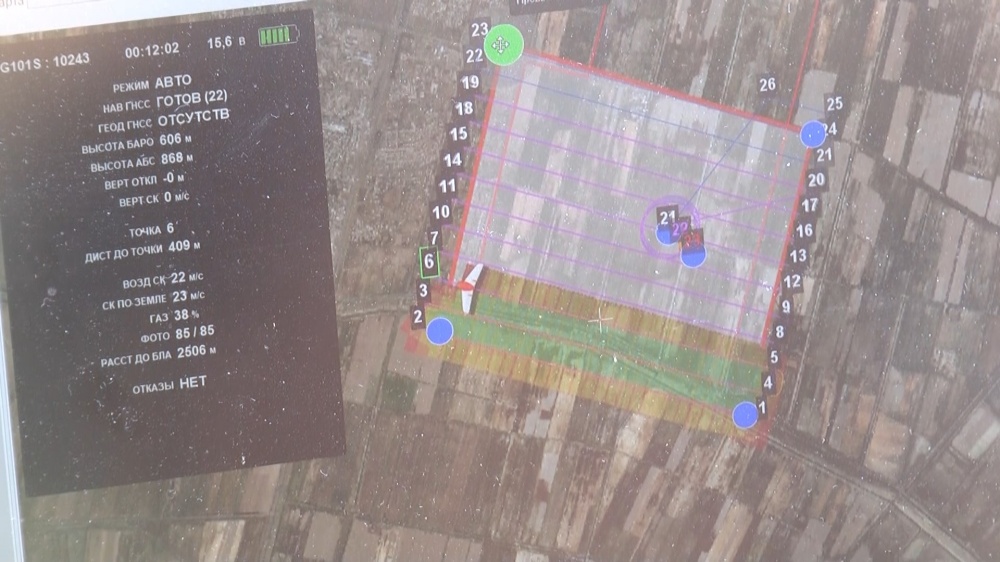
On January 15-17, 2019 "AgroDronGroup” representatives in Pakhtakor district of Jizzakh region, together with a Jizzakh branch of the Agency studied land areas of agricultural designation and conducted works of the first stage on implementation of remote analysis using air drones for this purpose.
AgroDronGroup specialists have conducted aerial survey of the land plots of Pakhtakor district. In addition, the Republican Soil-Agrochemical Station has performed some researches to define the soil condition of idle fields.

AgroDronGroup develops and implements unique methods for the analysis of agricultural crops by remote sensing techniques using air drones, digital and multispectral aerial photography. This technology has been developed in consultation with the leading specialists of Moscow State University named after M.V.Lomonosov, Institute of Agrochemistry named after D.N. Pryanishnikov, Agrophysical Research Institute, Research Institute of Biological Plant Protection and other institutions.

According to the results of aerial surveys and agrochemical researches the relief analysis, |cartographic engineering, soil laboratory examinations are to be implemented to provide:
1. Orthophotomaps (subject to define the field boundaries and coordinate dimensioning).
2. Digital model of the relief plane.
3. Slopes and streams maps.
4. Content of basic nutrients in the soil.
5. Content of essential trace elements in the soil.
6. Irregularity maps in the distribution of nutrients and trace elements in the fields.
Based on the data obtained at the first stage of research, the company's specialists will develop recommendations to improve the efficiency of the use of surveyed lands, to adopt precision agriculture technologies in Jizzakh region and will provide recommendations on the crops to be cultivated within the surveyed fields taking into account the climatic and soil characteristics of the region.

In subsequent phases the aerial photography using multispectral (hyperspectral) camera will be conducted during various phases of development of crops which will allow to control the quality of seed and condition of seedlings, to mark out defective areas of the fields, to control the crops development dynamics, to perform analysis of the distribution of nitrogen in crop plants (based on spectral aerial photography and multimeter readings), to predict the yielding capacity and to determine the gathering priority stages.
A full range of measures for the implementation of such technologies will allow to achieve a significant increase in the yield and farming earnings up to 70-90%.
